
Commuting by bike
As an avid cyclist, I feel very fortunate to live in Boulder, Colorado and be surrounded by over 300 miles of bike lanes, routes and paths. When the weather is cooperating, I try to commute to work every day. It’s a great way to stay healthy and arrive at the office feeling awake! According to Biking Directions in Google Maps, it takes me 10 minutes to travel 2 miles from Point A (my house) to Point B (the office). It also shows three alternative routes, and I can check the weather in Google Maps to see if I’ll need a rain jacket for the ride home. I can also use Biking Directions on my mobile phone, which came in handy for me during a biking trip in Austin when I got lost on a major highway and needed a safe route back to the hotel.
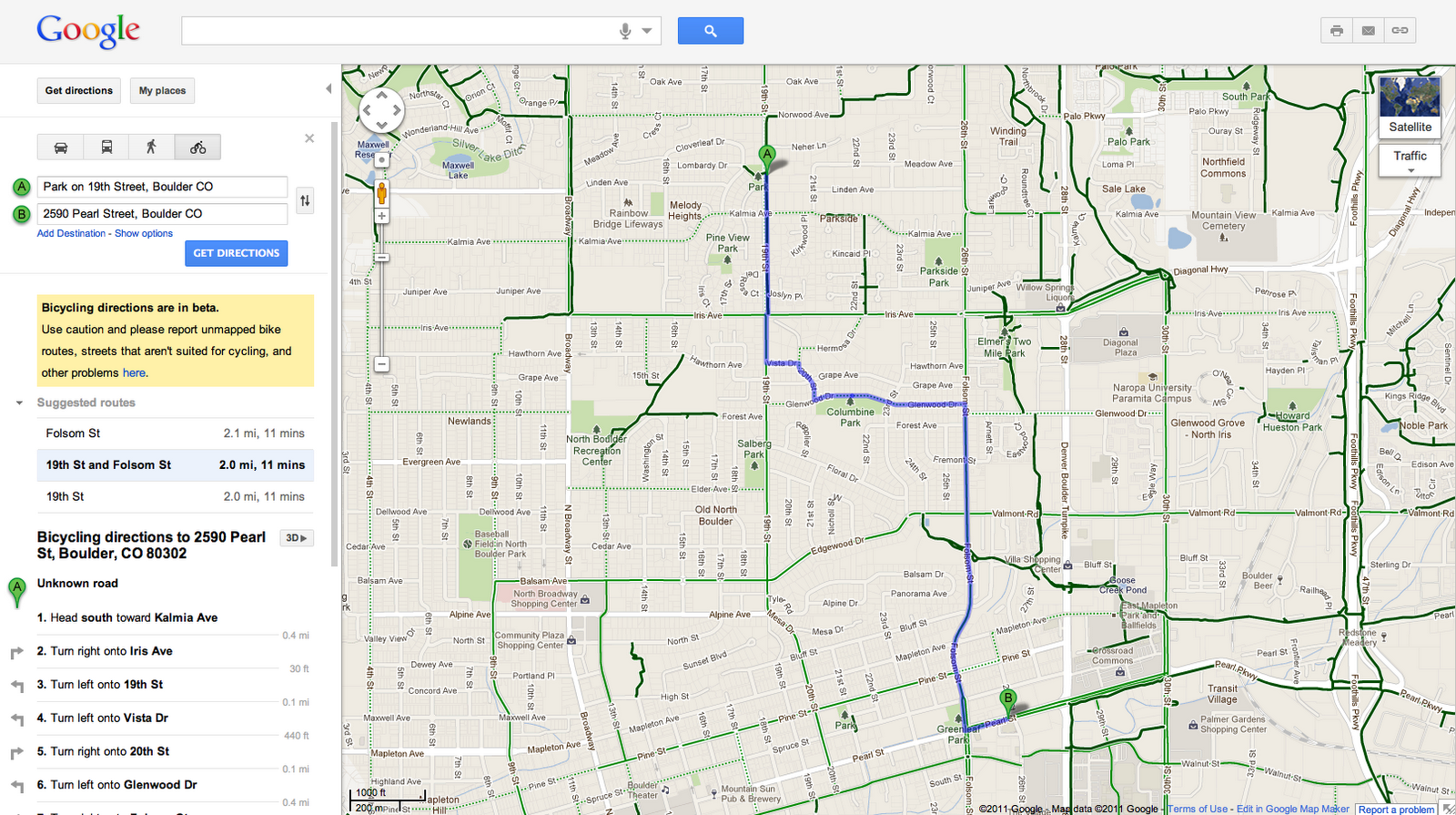
Did you know that Google Maps has biking directions available in over 200 US cities and in 9 Canadian regions? A collaboration with Rails to Trails, an organization that converts old railroad tracks into bike paths, has made information about over 12,000 miles of bike paths available to Google Maps users.
Taking public transit
Millions of people use Google Transit every week, viewing public transit routes on both Google Maps and Google Maps for mobile in over 470 cities around the world. You can take a train from Kyoto to Osaka or find your way around London on the Tube. In some places, you can compare the cost of taking public transit and driving by viewing the calculation below the list of directions (like in this example). Feel free to customize your routes and departure and arrival times under “Show options” to minimize walking or limit the number of transfers. You’ll know if your bus is late by checking out live transit updates.
Being green in the car
According to the 2011 Urban Mobility Report by Texas Transportation Institute at Texas A&M University, motorists wasted 1.9 billion gallons of fuel last year in the US because of traffic congestion, costing the average commuter an additional $713 in commuting costs. You can save time and money by clicking on the Traffic layer in the top right corner to view real-time traffic conditions on your route, and then drag and adjust your route to green. If you need directions in advance, save paper by sending your directions directly to your car, GPS, or phone. The Send-to-Car feature is available to more than 20 car brands worldwide, and the Send-to-GPS feature is available to more than 10 GPS brands. And for those of you who drive electric vehicles, you can search for electric vehicle charging stations by typing “ev charging station in [your city]” and recharge.
As you can see, Google Maps is loaded with features to help you save time, save money, and get where you need to be -- all while minimizing your commute’s impact on the environment. Go green with Google Maps, and safe travels!
Posted by Tasha Danko, Geo Team


No comments:
Post a Comment