
The week we spent at Rio+20 incredibly productive and rewarding. We marveled at the natural beauty of our surroundings, we took hundreds of visitors to our booth for a wild ride on the Liquid Galaxy, and we met with some of the world’s leading experts on sustainable development.
Several of those experts participated in our official Side Event, titled “Tools for Mobile Data Collection: From the Ground to the Cloud” on Monday, June 18th. We’ve been using the “ground to the cloud” phrase a lot these days. It was coined by Vasco van Roosmalen of ECAM, who helped the Surui tribe of the Brazilian Amazon get certification to enter the carbon credit market.
The idea is that data can be collected offline -- using, for instance, Android smartphones and open-source software called Open Data Kit (ODK) -- and then, back in an online environment, uploaded to Google cloud services (like Google Maps Engine) to display in a map. The Surui use this method to collect ground data for their carbon offsets project, and if you download the recently launched Surui Cultural Map you can see exactly where they collected their data. The Surui expect to avoid the emission of 6 million tons of carbon over the 30 years by avoiding the deforestation of 40 thousand hectares of forests and protecting an additional 200,000 hectares.
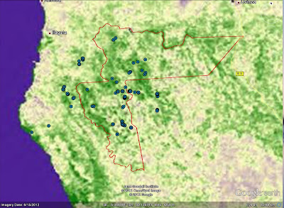
Two other participants at our event, Fundação Amazonas Sustentável (FAS) and The Jane Goodall Institute demonstrated the importance of community participation in keeping trees standing. FAS is using Open Data Kit to monitor and manage the forest reserves in Juma, Rio Madeira Reserve and in Rio Negro in the Brazilian Amazon. Dr. Lilian Pintea, with Timothy Akugizibwe, Sood Ndimuligo and other Jane Goodall Institute staff, trained over 100 Village Forest Monitors in Tanzania and Uganda to take part in protecting their forest. They’ve also mapped chimpanzee distribution alongside biomass models from Dr. Alessandro Baccini of Woods Hole Research Center (see credits in photo caption).
This is very exciting because it has never been done before. Now, stakeholders in Tanzania and elsewhere can substantially cut their hardware, software and data storage and management costs. They can now fully focus fully on comparing the biomass model with what’s actually on the ground, and develop maps and statistics that better meets decision-makers' information needs. The new biomass map of western Tanzania shows the amount of biological material (and carbon) in the region, and could be an important predictor for modeling potential distribution of chimpanzees in the region.
 |
| From Rio+20 |
According to partner Aliança da Terra, it is possible for Brazil's farmers to help feed the world, contribute to economic development, and find a balance with our global human and environmental needs. They’ve created a Registry of Socio-Environmental Responsibility for Brazilian producers of soy, cattle, corn and other crops who want to practice their trade in a way that complies with Brazilian law and doesn’t degrade their land for future farming activities. They launched their new website at the side event, featuring maps of the 400+ properties in the Registry as well as their fire brigades to stop the spread of fire in the Amazon. These maps were created with Google Maps Engine, and Aliança da Terra was one of the early grantees of the Google Maps Engine Grants program.
 |
| From Rio+20 |
We were joined by other inspiring speakers on the Ground to the Cloud Story, including World Resources Institute, who previewed their Global Forest Watch 2.0, the Governors’ Climate and Forests Task Force & IPAM, and Imazon (who made their own announcement earlier this week). The important work they’re doing brings a quote from Sir Winston Churchill to mind:
“What is the use of living, if it be not to strive for noble causes and to make this muddled world a better place for those who will live in it after we are gone?”
Posted by Tanya Birch, Google Earth Outreach Team


No comments:
Post a Comment